Poorpa Yanyeen Meerreeng
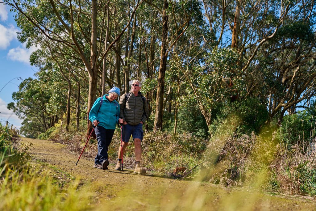
Take your time to notice the little things: scent, sound, the feel of wind on your skin. With each twist and turn the true wonder of Keerray Wooroong Country is slowly revealed.
Travel through tall forest, rolling dairy pasture, coastal heath and estuarine wetland to the rugged limestone cliffs and blue depths of the Southern Ocean. You’ll be glad you came.
Key Information


Distance: 19.3km
Difficulty: Easy (bike) Moderate (walk)
Estimated Time: Bike 1.5 – 2.5hrs | E-bike 1.5 – 2 hrs | Walk 3.5 – 6 hrs
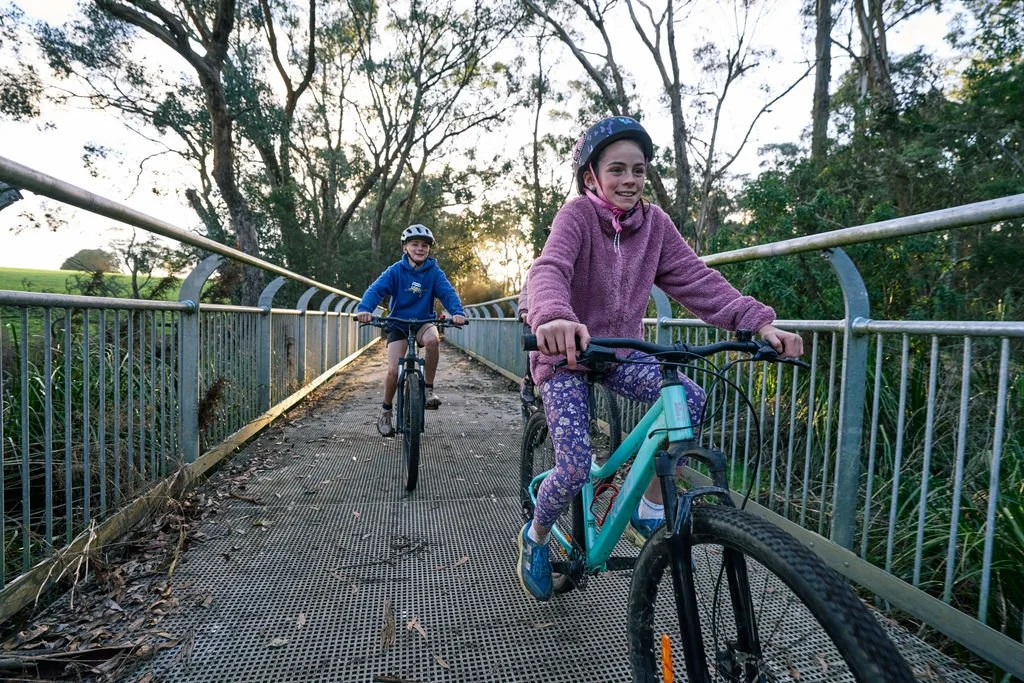
Trail Type: Multi-purpose two - way trail with 90% crushed gravel and 10% boardwalk and paved surface treatments. Maximum gradient range +4% -5.4%. For detailed accessibility information see below.
Trail Sections
-
8 km crushed gravel
Walk: Easy (1.5 hrs)
Bike: Medium (30 mins)
Climb out of town through tall wet forest, farm/forest verge with impressive boardwalk and bridge infrastructure to navigate wet areas and cattle underpasses. Midway refreshment at Schulz Organic Creamery and Café. Water refill, toilets and toolkit at Paaratte.
Accessible (gravel)
Top Tips:
On foot? Walkers look out for tracks along the course of Power Creek that diverge and converge back onto the main trail. Koalas are sometimes sighted on this section.
Look for curious cows grazing on pasture. The larger black and white Fresian and smaller caramel coloured Jersey cows are key to the regional dairy industry.
A tasty Timboon return - A popular option for locals and families is a 12km out and back route to Schulz Organic Creamery and Cafe. Stop for a coffee and housemade gourmet treats. You know you’ve earned it!
-
10 km crushed gravel, bridge crossings
Walk: Easy (2 hrs)
Ride: Easy (1hr)
The trail undulates on the forest edge through farmland with increasing ocean views. Cattle overpasses punctuate shifts in scenery through lower coastal forest and clifftop heath on approach to Port Campbell Lookout.
Mostly accessible (gravel)
Top Tips:
Historically smaller farms meant larger communities. The wooden shelter shed and remnant tennis courts you see today were once part of larger precinct including the Paarratte School
What will it be first? The scent, sounds or sight of the sea? This section is a slow reveal as taller trees give way to coastal specialists, and a thin blue horizon grows.
-
1.5 km paved and boardwalk.
Walk: Easy (15 mins)
Bike: Easy (5 mins)
Enjoy elevated views on descent to a wetland boardwalk. Take in the sights and take a deep breath. The air smells different here. Fall into the relaxed easy sway of a village by the sea. Refreshment, reward and welcome wait at journeys end.
Accessible (paved)
Top Tips:
Walkers at this point can choose to head out onto the eastern headland of Port Campbell on the Port Campbell Discovery Walk 4km return A left turn 300m along the track leads to steps and a suspension bridge short cut into town.
A short track near the bike rack leads to a lookout overlooking Port Campbell Bay. offering views of Port Campbell’s sheltered bay and the deep blue Southern Ocean beyond.
This section of the trail forms part of a popular walking and running route for residents and holiday makers. Check your speed and give way to slower and more vulnerable users.
Trail Safety Considerations
Tell someone your plans.
Know your limits and check your gear.
Be visible and use a taillight if riding on the road.
Prepare for weather, pack waterproofs & sunscreen.
Take water, snacks and a first aid kit.
Charge your phone.
Fully charge E-bikes (no recharge points).
Bring a puncture kit.
Carry a torch or bike light.
Trail users need to be aware of weather conditions and daily Fire Danger Rating. It is highly recommended trail users have the Emergency Vic app and the Emergency app downloaded on their phones.
In an emergency, call 000.
Keeping Trail Friendly
Respect private property, other trail users, environment and local communities.
Do not jump fences or open gates.
Do not disturb farm animals or stock.
No smoking, naked flames, or fires.
No camping.
Dogs on leads please carry collection bags.
Take rubbish with you (bins in townships only).
Bike riders must wear helmets, dismount on bridges and trestle bridge bypass sections.
No motorbikes or unauthorised vehicles.
Pedal assisted e-bikes and scooters less than 250w permitted.
Give way to slower, more vulnerable users.
Rider Information
The recommended minimum tyre width for cyclists on the crushed gravel surface is 32mm. Wider tyres will offer better handling.
While suitable for bikes without suspension, front suspension will assist less experienced riders to handle the gravel surface.
Accessibility
Most of the trail is crushed gravel, trail width and absence of steep inclines make the trail suitable for walking, running, cycling, adaptive cycling, prams, mobility scooters and motorised wheelchairs that are suitable for gravel surfaces. The 1.5km (3km return) paved boardwalk section between Port Campbell and Port Campbell lookout is suitable for motorised wheelchairs with gradients that sit within the 1:14 gradient standard of AS 1428.1
With a maximum trail gradient of 4% and -5% and an off road setting this trail would be considered easy for riders and more challenging in consideration of length for walkers.
Individual sections of the trail have been graded as:
Accessible – 2.5m paved and rollable boardwalk sections and wider gravel sections with gradients (less than) 3%
Mostly Accessible – Wider gravel sections with sectional gradients between 3% and 5%
Limited Accessibility – May be suitable for adaptive cyclists on equipment designed for mountain bike trails.
Nearby Highlights and Trails